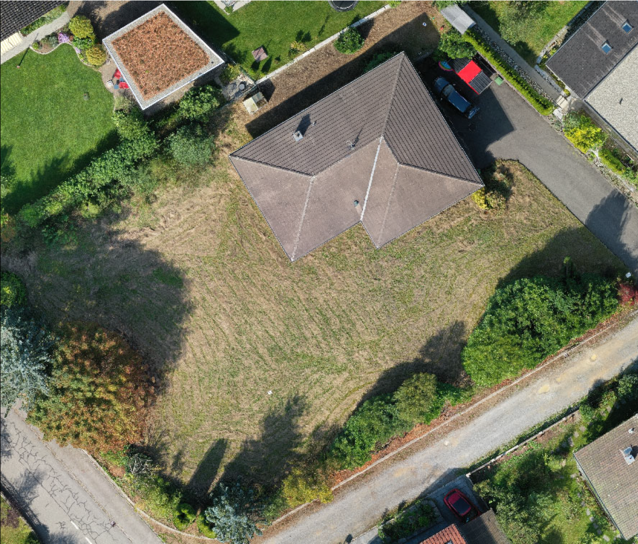
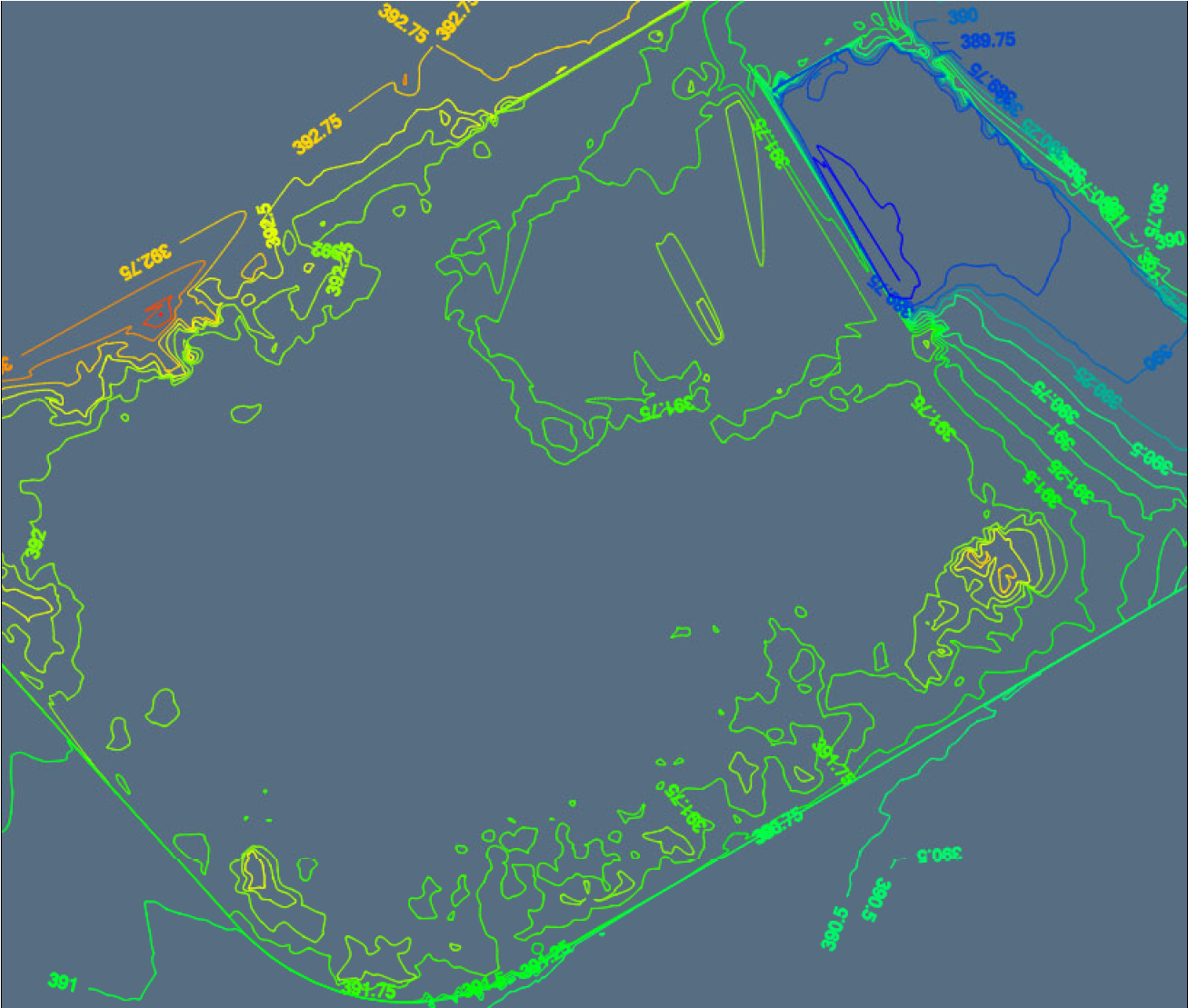
Together with a private builder, we defined the framework of the required primary data in close consultation. In addition to a height profile of the extensive plot, which was previously built on a single-family house, the height connections to the neighboring streets and properties were also created. By using the laser scanner, data of the entire parcel as well as the surrounding area could be captured in a short time. Elevation profiles, sections, an orthophoto as well as a meshed elevation model could be created in the office. Due to the acquisition of the data in the national coordinate system, precise elevation data above sea level could be taken for the architect's plan preparation. Since the 360° view of the laser scanner also captures parts of directly neighboring parcels, additional information could be extracted for the visualization of the building project, and the model of the new building could be fitted into the surroundings.
Since our modern measuring equipment reduces the field service time and can be carried out by only one employee, the project was completed in a time and cost-efficient manner for our client.
· Elevation profile
· Digital terrain model
· Orthophoto
· 360° panoramas
· Surrounding details
· Connection points